Little Navmap (리틀네브맵) 에서 비행 경로 만들기
리틀네브맵은 MSFS의 비행경로(PLN)파일을 생성하는 프로그램이다.
리틀네브맵 설치
리틀네브맵 프로젝트 페이지는 아래 링크에 있다.
https://albar965.github.io/littlenavmap.html
Alex Projects - Little Navmap
Alex’ Projects ► Little Navmap Little Navmap Links ► Releases and Downloads ► Translation Packages ► Screenshots ► Screenshots of new 2.8 Features ► Screenshots of new 2.6 Features ► User manuals for Little Navmap and Little Navconnect in a
albar965.github.io
https://github.com/albar965/littlenavmap/releases
다음 깃허브 페이지에서 최신의 네브맵 설치파일을 다운로드 한다
Releases · albar965/littlenavmap
Little Navmap is a free flight planner, navigation tool, moving map, airport search and airport information system for Flight Simulator X, Microsoft Flight Simulator 2020, Prepar3D and X-Plane. - ...
github.com


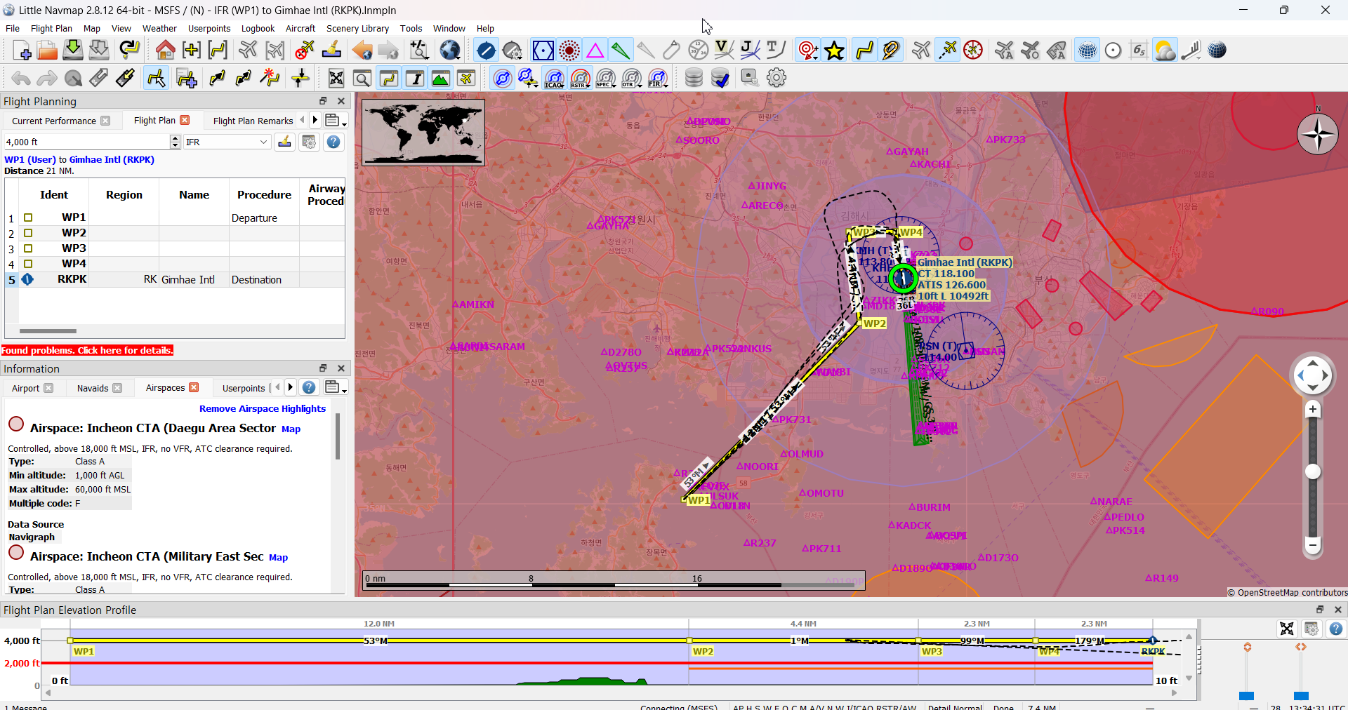
Little Navmap에서 생성한 플랜 모습

BushMissionGen(BMG) 프로그램으로 내보내기
이제 만들어진 PLN파일을 MSFS에서 인식할 수 있는 패키지로 만들기 위해 BMG 프로그램을 설치한다.
다운로드는 다음 경로에서 가능하다. (Flightsim.to 가입이 필요함)
https://flightsim.to/file/3681/bushmissiongen
BushMissionGen for Microsoft Flight Simulator | MSFS
Recent Changelog for 4.24 - poiStripHTML field to handle HTML tags in POI TTS dialogs and dialog entries. - Only create localization files for handled languages. Thanks to Frontech for bug reports, suggestions, testing and more!
flightsim.to
자세한 사용 방법은 다음 동영상을 참고한다.
https://youtu.be/JCfpbqIP2cQ?si=LU3LNlo5jhXLDJyq
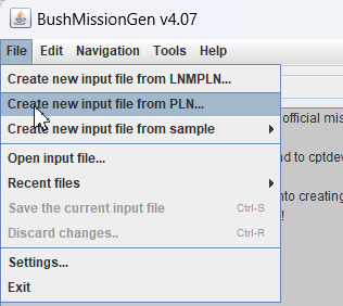
BushMissionGen(BMG)에서 plan 불러오기

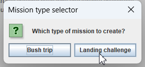
미션 타입을 Landing challenge로 선택

적절한 챌린지 타입을 선택

저작자 이름, 제목, 간단한 설명등을 입력한다.

BushMissionGen에 넣을 인풋 파일
# Input file for BushMissonGen
#
# Auto-generated in v4.07

author=Kyubot
title=Gimhae landing VOR DME-A 18R
project=rkpk-rwy18r
version=1.0.0
location=Gimhae Intl
plane=Airbus A320 Neo Asobo
tailNumber=N9999DE
airlineCallSign=HL
flightNumber=1234
introSpeech=
simFile=runway.FLT
parkingBrake=0.00
description=Circle to land Gimhae 18R, ROK
loadingTip=Generated by BushMissionGen.
intro=Try to land one of the most challenging approach to Gimhae RWY 18. You are located 15 DME from KMH R225. Maintain heading 45 until D3 and enter downwind. Then make right turn to land runway 18R while avoiding terrains.
latitude=N35°0'11.82"
longitude=E128°43'23.49"
altitude=+4000.00
pitch=0
bank=0
heading=45
weather=.\WeatherPresets\FewClouds.WPR
season=SUMMER
year=2022
day=167
hours=12
minutes=30
seconds=0
missionType=landing
challengeType=Famous
velocity=200

#icao rw    name        type            LL                   alt
||CUST0|U|N35° 0' 11.82",E128° 43' 23.49"|+004000.00
||CUST1|U|N35° 0' 11.82",E128° 43' 23.49"|+004000.00
||CUST2|U|N35° 8' 41.63",E128° 53' 42.73"|+002700.00
||CUST3|U|N35° 11' 53.59",E128° 53' 12.74"|+001683.60
||CUST4|U|N35° 13' 17.91",E128° 55' 41.66"|+000854.25
RKPK|18R|RKPK|A|N35° 10' 50.01",E128° 56' 16.98"|+000010.00'Flying > Flight_Study' 카테고리의 다른 글
| 제주항공 참사 의혹만 키우는 국토부 (0) | 2025.02.04 |
|---|---|
| 제주항공2216편 추락사고 의문점 (0) | 2024.12.31 |
| MSFS2020 김해 VOR DME 18R 써클링 랜딩 첼린지 (0) | 2022.06.09 |
| 아시아나 항공에서 11년 근무한 기장이 생각한 OZ214편 사고의 원인 (1) | 2019.12.30 |
| LION Air JT610 Boeing 737 MAX 추락 사고 (0) | 2018.10.30 |